European Satellites Track 'Killer Waves'
July 29, 2004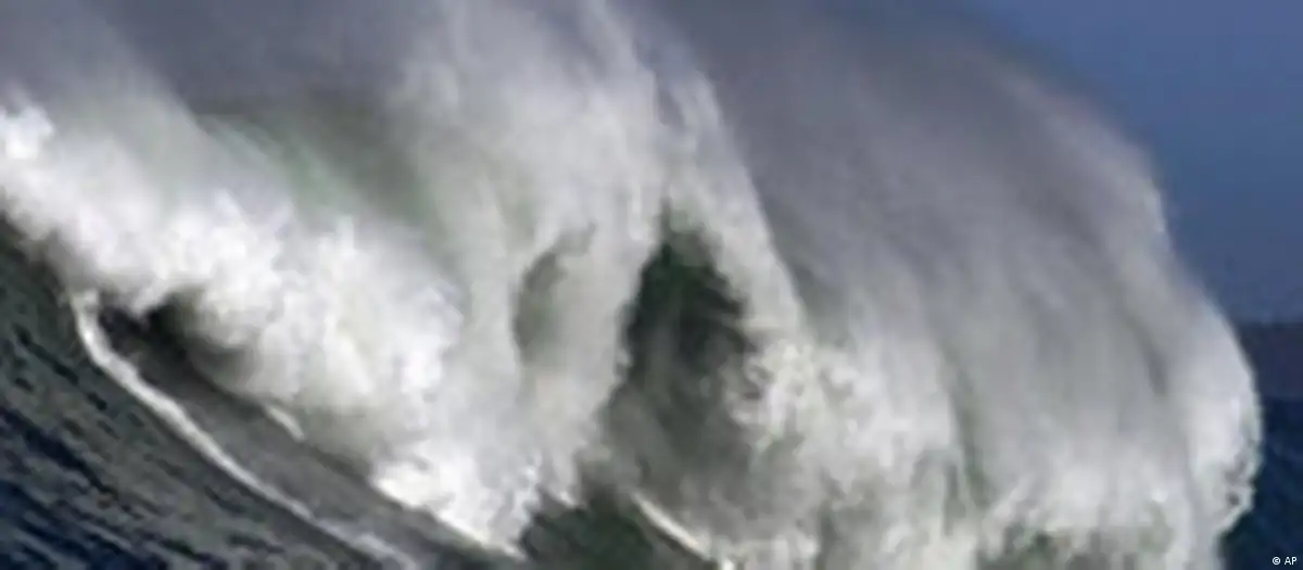
More than 200 massive cargo ships sank over the past two decades and some of them could have fallen victim to "freak" ocean waves as high as 50 meters (162 ft), the European Space Agency (ESA) said last week.
The findings are the result of data relayed by ESA's earth-scanning satellites, ERS-1 and ERS-2, which routinely monitor the oceans with their radar.
The satellites were deployed as part of a project called MaxWave set up by a consortium of 11 organizations from six EU countries in 2000. They were meant to probe longstanding rumors -- often dismissed by marine scientists as pure fantasy -- that towering killer waves were responsible for the mysterious disappearance of ships.
"Two large ships sink every week on average," Wolfgang Rosenthal, of the GKSS Research Center in Geesthacht, Germany, said in a statement. "But the cause is never studied to the same detail as an air crash. It simply gets put down to 'bad weather'."
"A great wall of water"
Tales abound of ships and liners that survived such encounters.
In February 1995 the cruise liner "Queen Elizabeth II" met a 29-meter high (85 feet) rogue wave during a hurricane in the North Atlantic. Ronald Warwick, the ship's captain, described it as a "great wall of water, it looked as if we were going into the White Cliffs of Dover."
The killer waves have also engulfed offshore platforms. In January 1995, the Draupner oil rig in the North Sea was hit by a wave measuring 26 meters (82 ft) in height.
As recently as 2001 two tourist ships, "The Bremen" and "The Caledonian Star," encountered turbulent 30-meter-high waves in the South Atlantic. The latter ended up drifting without navigation or propulsion for two hours.
"The incidents occurred less than a thousand kilometers apart from each other," said Rosenthal. "All the electronics were switched off on the Bremen as they drifted parallel to the waves, and until they were turned on again the crew were thinking it could have been their last day alive."
Revolutionary data
Though scientists have been aware of the existence of the rogue wave phenomenon on the basis of measurements, so far statistics have shown that there haven't been monstrous deviations from the normal sea state and that they only occur every 10,000 years.
But the new data gathered by the ESA satellites blows apart that theory. The satellites sent back "imagettes" or pictures of the sea surface in a rectangle measuring 10 by 5 kilometers (6 by 2.5 miles), which were taken every 200 kilometers.
Around 30,000 separate images were produced by the two satellites during a three-week period in 2001. During that time they detected 10 giant waves, all of which were over 25 meters high.
"With that we have proved that they (killer waves) exist and much more clearly than previously thought," said Rosenthal. "The next step is to analyze if they can be forecasted," he added.
Worldwide rogue wave atlas
In the next phase of research, a project called WaveAtlas will use two years worth of ERS imagettes to create a worldwide atlas of rogue wave events and carry out statistical analyses. The aim will be to find out the reasons for the cataclysmic phenomenon and identify which regions of the sea are most at risk.
The scientists involved in the ESA project are clear they are on the right track.
"Only radar satellites can provide the truly global data sampling needed for statistical analysis of the oceans because they can see through clouds and darkness," Susanne Lehner, Associate Professor in Applied Marine Physics at the University of Miami who worked on the MaxWave project said.