Taking a New Look at Mars
January 14, 2004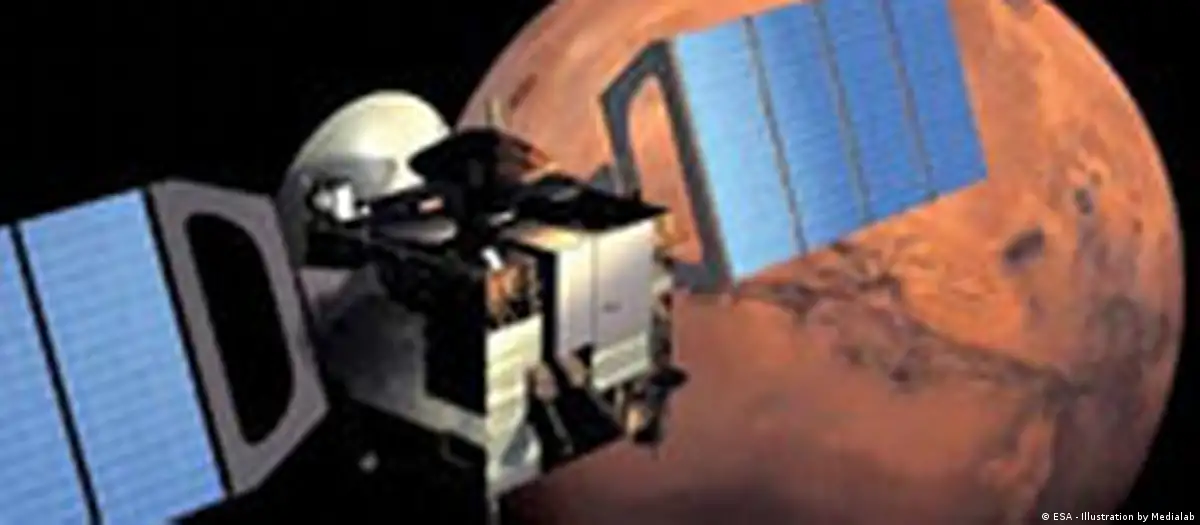
BERLIN-- Ralf Jaumann expects to feel a little edgy over the next two years. The planetary geologist at the German Aerospace Center’s (DLR) Institute for Planetary Research in Berlin will be one of the first people to receive data collected by the so-called High Resolution Stereo Camera (HRSC). “Every time we switch it on or off, I’m nervous,” said Jaumann, who will turn the data into raw images before sending the latter on for further analysis. “It will certainly become a matter of routine, but not completely.”
Last Friday Jaumann (photo) got another chance to jitter as the camera began searching for signs of the missing Beagle 2 lander. The robot probably crashed during touchdown on the Martian surface.
While Beagle 2 was designed to conduct a small percentage of the mission’s ground experiments, focus is likely to shift now to the camera and other instruments mounted on the orbiter, such as MARSIS, a sub-surface sounding radar altimeter searching for water under the planet’s crust, or SPICAM, an ultraviolet and infrared spectrometer that will study the Martian atmosphere.
Not all hope has been lost for finding the lander, however, and Jaumann and his colleagues have been given a lot of data storage space on the orbiter to search for Beagle 2. But neither he nor Gerhard Neukum, the HRSC project’s principal investigator at Berlin’s Free University, believe there’s much of a chance to discover the tiny robot.
“We haven’t seen Beagle yet,” Neukum said on Wednesday after looking through the first batch of “outstanding” data he’s received so far. Even though the probe hasn't turned up, "these are the best data ever recorded,” Neukum said.
While other missions, such as NASA’s Global Surveyor mission, have already produced high resolution images, the HRSC’s capability to produce colorful, three-dimensional pictures is a first, according to Neukum. “We will be able to look at Mars like we do with our eyes here on the surface of the Earth,” he said.
In addition, an infrared image would allow scientists to determine the abundance of specific minerals on Mars, Neukum said. He added that first images would be released to the public by Jan. 20.
Sending commands, receiving data
While Neukum and his team of 43 co-investigators will use the data to produce three-dimensional images and analyze them, Jaumann and a group of 10 scientists will be testing and sending future commands to the camera and processing incoming data on a daily basis.
The team doesn't work in a big mission control center like the one in Darmstadt, Germany, where the Mars Express mission and the orbiter's flight path is monitored. TV crews are often disappointed when they come to visit his office in a non-descript building on the outskirts of the German capital, Jaumann said. “Years ago we had rooms with big computers, but now we get our data on machines like this one,” he said, pointing to his Apple PowerBook.
To test commands, Jaumann and his colleagues can work with an exact replica of the camera, which sits in a DLR laboratory. Several dozen screws have to be adjusted to find the perfect position. “It’s nothing spectacular,” he said, pointing to the 20 kg (44 pound) instrument that’s mounted on a table. “But hopefully it will produce spectacular pictures.”
Mapping Mars like never before
The HRSC project’s goal is to produce a three-dimensional, colorful map of the entire Martian surface at a resolution that has never been achieved before.
Detailed images of the red planet’s polar caps or volcanic regions will be even more interesting for scientists working on the project, however. “It’s more interesting to do fewer things in great detail rather than to do everything at a resolution that we have done with other missions,” said Wojciech Markiewicz, a planetary scientist at the Max Planck Institute for Aeronomy in Katlenburg-Lindau in central Germany.
The camera’s images will allow scientists to locate rocks as small as two meters (6.5 feet), according to Jaumann, who added that he expects the project to answer the question whether it ever rained on Mars.
Putting the camera to work on Earth
The HRSC technology is not only useful for gaining a greater understanding of Mars, however: A modified version of the camera has already mapped regions on Earth. Many possibilities exist to put the instrument to commercial use, Jaumann said.
Telecommunication companies could use the images to pinpoint the best locations for their antennae, cities could take inventory of things such as street signs, park benches and trees by looking at the pictures, Jaumann said. Insurance companies could assess damage caused by floods immediately, hence preventing fraudulent claims later on. Even the European Union could monitor fields of farmers who receive subsidies for not planting anything on their land.
But others, who work in the commercial sector, will have to look into these options, Jaumann said, adding that data from the HRSC will keep scientists busy for years to come. “We’re still working with Apollo and Viking data today,” he said, referring to missions that ended decades ago.